Drone Photography for GTA Real Estate Listings: The Value, and the Rules That Protect You
Aerials answer the questions ground photos cannot. They also come with real rules, especially in the airspace over the GTA.
Some homes never look like much from the sidewalk. The lot is deep but you cannot see it. The house backs onto a ravine, or sits a short walk from the lake, or has a private yard the street view completely hides. Ground photos can only show so much. The moment the camera lifts fifty metres up, the whole story changes, and the buyer finally understands what they are actually looking at.
That is what aerial photography does for a listing. It gives context, and context is often the thing that turns a casual scroll into a booked showing. For GTA realtors, drone work has gone from a luxury add-on to something buyers increasingly expect, especially on larger lots, waterfront, and anything with a setting worth showing. But it also sits inside a regulatory framework that a lot of agents have never had a reason to think about, and that part matters more than it might seem.
What aerials actually show a buyer
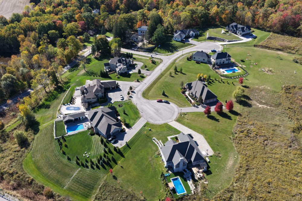
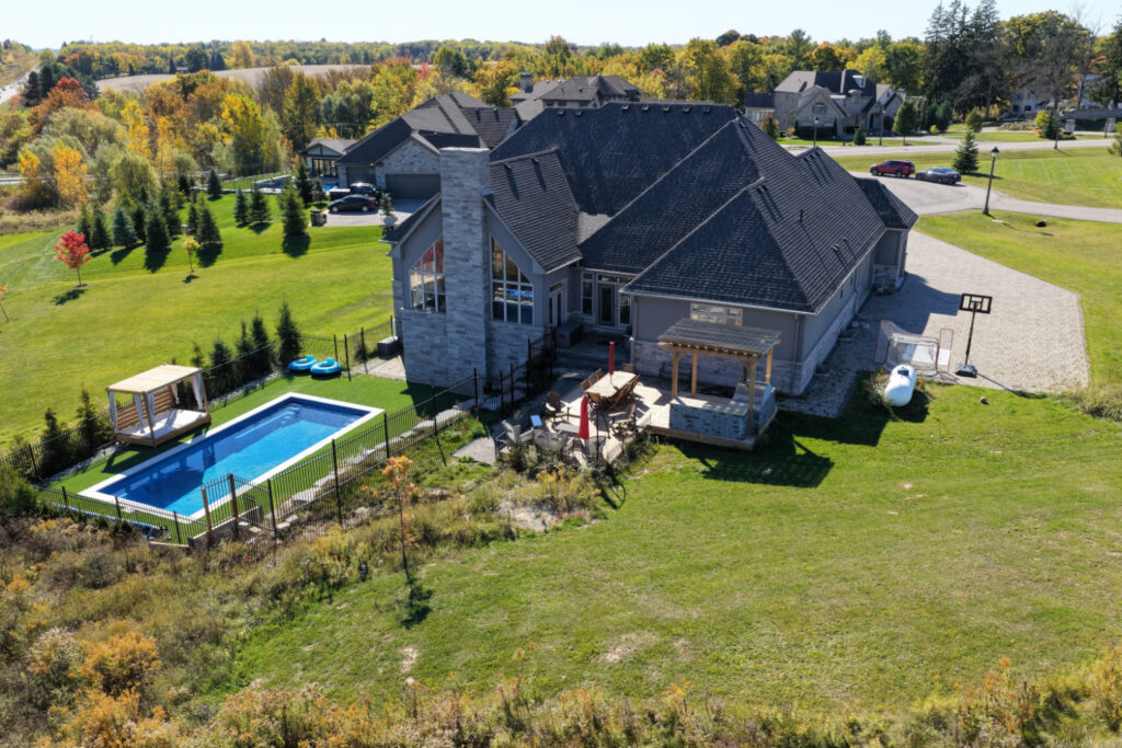
A good aerial does a few things a ground photo cannot. It shows the lot: where the property lines fall, how big the yard really is, how the house sits on the land. It shows the setting: the ravine behind, the park across the street, the marina down the road, the tree cover, the quiet cul-de-sac. And it shows proximity, which is half of what buyers are really asking about. How close is the lake. What is the next street over. What does the drive to the highway look like.
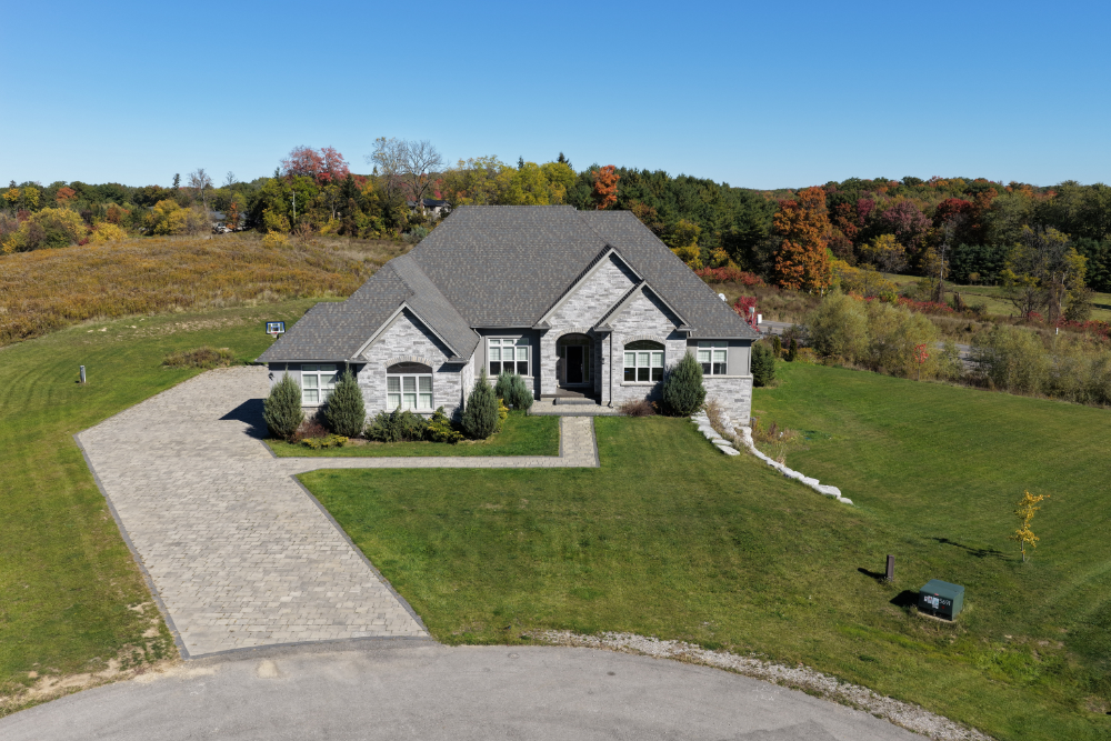
For the right property, that context sells. A deep pie-shaped lot looks ordinary at ground level and impressive from above. A home near the water gains a completely different appeal once a buyer can see the water in the same frame. Even a straightforward suburban home benefits from a clean overhead that shows a well-kept yard and a pleasant street. Aerials answer the spatial questions that text and ground photos leave open.
The part most agents do not think about: the airspace
Here is where it gets specific to the GTA. Drones are legally aircrafts in Canada, regulated by Transport Canada, and a large part of the GTA sits under or near controlled airspace. Toronto Pearson is one of the busiest airports in North America, and its control zone reaches across a wide stretch of Mississauga, Brampton, Etobicoke, and beyond. Add Billy Bishop downtown and the various heliports, and a surprising number of listings fall in airspace where you cannot simply launch a drone and start filming.
To fly legally in controlled airspace, a pilot needs an Advanced certificate from Transport Canada plus a flight authorization from NAV CANADA for that specific location. Flying near or over people, which is almost unavoidable in a residential neighbourhood, also requires Advanced certification rather than the basic level. A hobbyist with a consumer drone and a Basic certificate is not cleared for most of this work, even if they do not realize it.
What changed, and why a certified operator matters
Canada updated its drone rules significantly, with the current framework taking effect on November 4, 2025. The changes modernized how the country handles everything from registration to more complex operations, and they came with sharper enforcement. Penalties for breaking the rules now run up to $3,000 for an individual and up to $15,000 for a corporation, on top of the headache that comes with an aircraft incident near a major airport.
The basics still apply to every drone over 250 grams: it has to be registered, and the pilot has to carry a valid certificate. The reason this matters to you as the listing agent is simple. When you hire someone to shoot aerials of your listing, you are trusting that they fly legally, that they hold the right certificate, that they have pulled the authorization where it is required, and that they carry proper liability insurance. If they do not, the problem does not stay with them. It is your listing, your seller’s property, and your name attached to the marketing.
Why this is really a reputation question
It is tempting to treat drone footage as a commodity, where the only question is who is cheapest. The airspace over the GTA is the reason that thinking is risky. A cut-rate operator flying without certification near Pearson is not a hypothetical problem. It is a real liability that can end with grounded footage on a delivery deadline, a complaint, or worse. None of that is a position you want to be in the week a listing goes live.
Working with a properly certified operator removes that whole category of risk. The aerials come back clean, on time, and flown by someone who treats the registration, the certificate, and the NAV CANADA authorizations as a normal part of the job rather than an afterthought. You get the footage that sells the lot, without inheriting the legal exposure that comes with the alternative.
Aerials are one of the most effective ways to show a property’s true setting, and on the right listing they make an obvious difference. They just need to be done properly, which in the GTA means done legally. That is the standard we hold ourselves to: licensed, Advanced-certified flying with the right authorizations, so the only thing you have to think about is how good the footage looks. If you have a listing where the lot or the setting deserves to be seen from above, RCG Canada Aerial Solutions handles the aerials and the airspace across the Greater Toronto Area.